
Government Solution
A coordinated intelligence foundation for city operations and public services
Make city operations visible, incident coordination more effective, and public services more dependable.Urban governance is moving beyond isolated systems toward continuous coordination across departments, administrative levels, and operating scenarios. Data arrives from agencies, sensors, service channels, and specialist platforms, while every incident must move coherently through discovery, assessment, dispatch, field response, feedback, and review. Adding another dashboard or portal cannot resolve inconsistent definitions, disconnected workflows, or unclear operating accountability on its own.
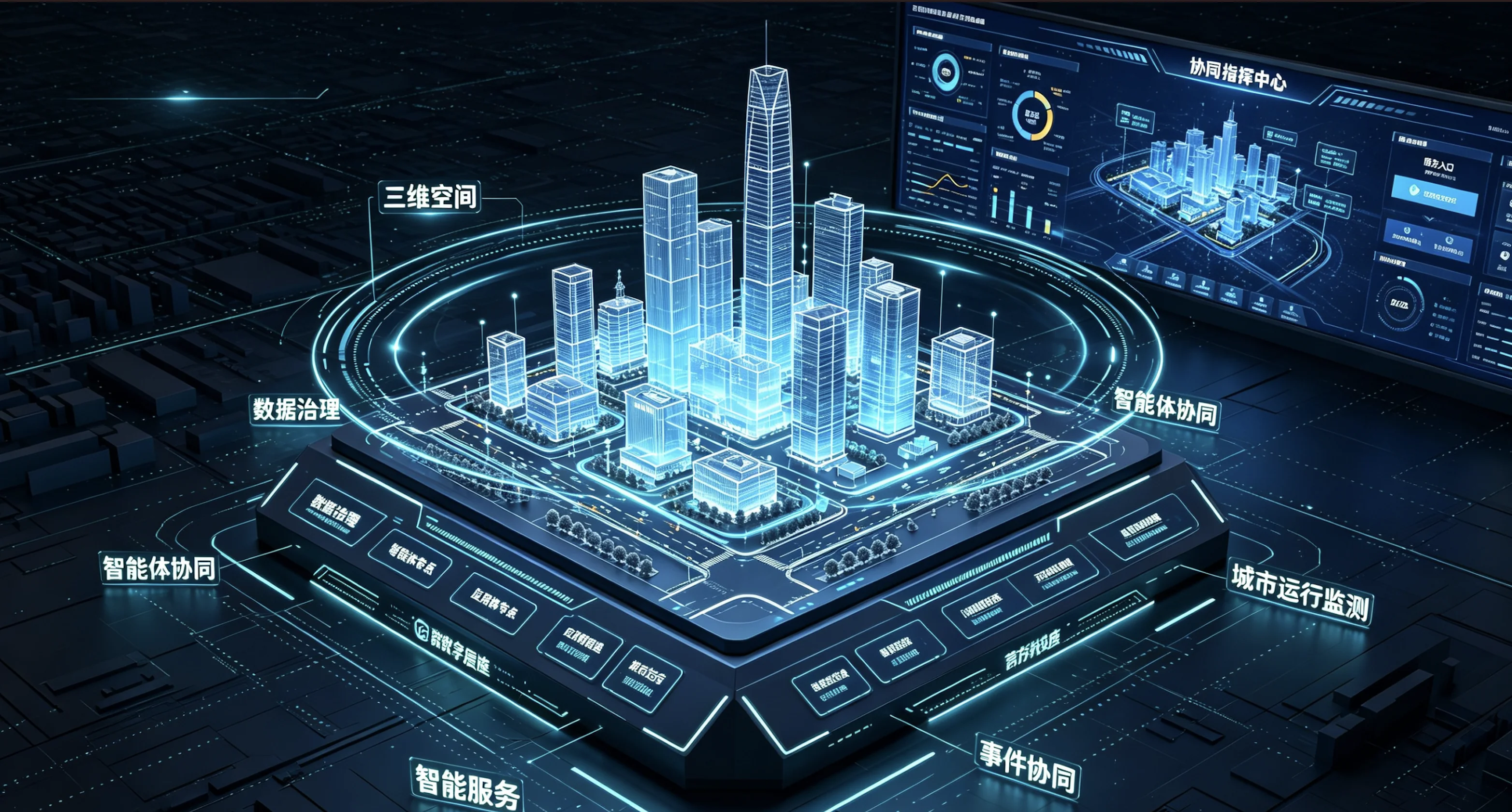
Qukai's government solution organizes spatial information, governed data, intelligent analysis, and application delivery around a shared city foundation. It serves operations managers, departmental teams, field responders, and public-service staff. City conditions become easier to understand, work moves through explicit responsibilities, and every response produces a traceable record that can improve the next decision, rule, workflow, or service design.
Designed for
- Urban operations authorities
- Government departments and local governance teams
- Public-service and municipal organizations
Core goals
- Create a shared view of city operations
- Establish coordinated incident workflows
- Build reusable and sustainably operated governance capabilities
Business challenges
Move from isolated systems to continuous coordination
Connect urban space, governed data, and departmental workflows through one digital foundation for operations monitoring, incident response, government services, and decision support, while building reusable capabilities through continuous operations.Fragmented data prevents a shared operational judgment
Population, organization, spatial, incident, and sensor data remain distributed across systems with different update cycles, identifiers, and owners. Managers must reconcile several platforms before making a decision and often cannot explain which sources support a particular conclusion.
Cross-department incidents lose continuity as they move
Citizen reports, service hotlines, inspections, and device alarms enter separate channels. Duplicate signals are difficult to merge, responsibility can be disputed, and incomplete field feedback prevents command teams from knowing whether the underlying issue has actually been resolved.
Frontline staff repeat the same work across many systems
Each specialist application may introduce another account, form, and workflow. Local staff search, enter, and report the same information in multiple places, creating operational burden and contradictory records for one matter.
Completed projects lack an operating model for continued change
Launch is only the beginning. Rules, data, organizational responsibilities, and service expectations keep changing. Without daily ownership for data quality, model behavior, workflow health, and user feedback, the platform gradually separates from real governance work.
Solution architecture
One foundation for sensing, data, intelligence, and application coordination
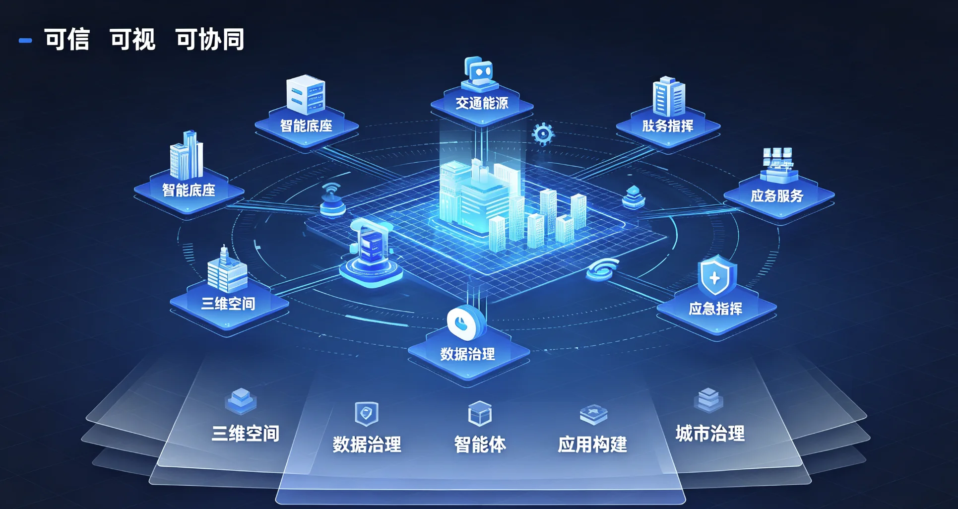
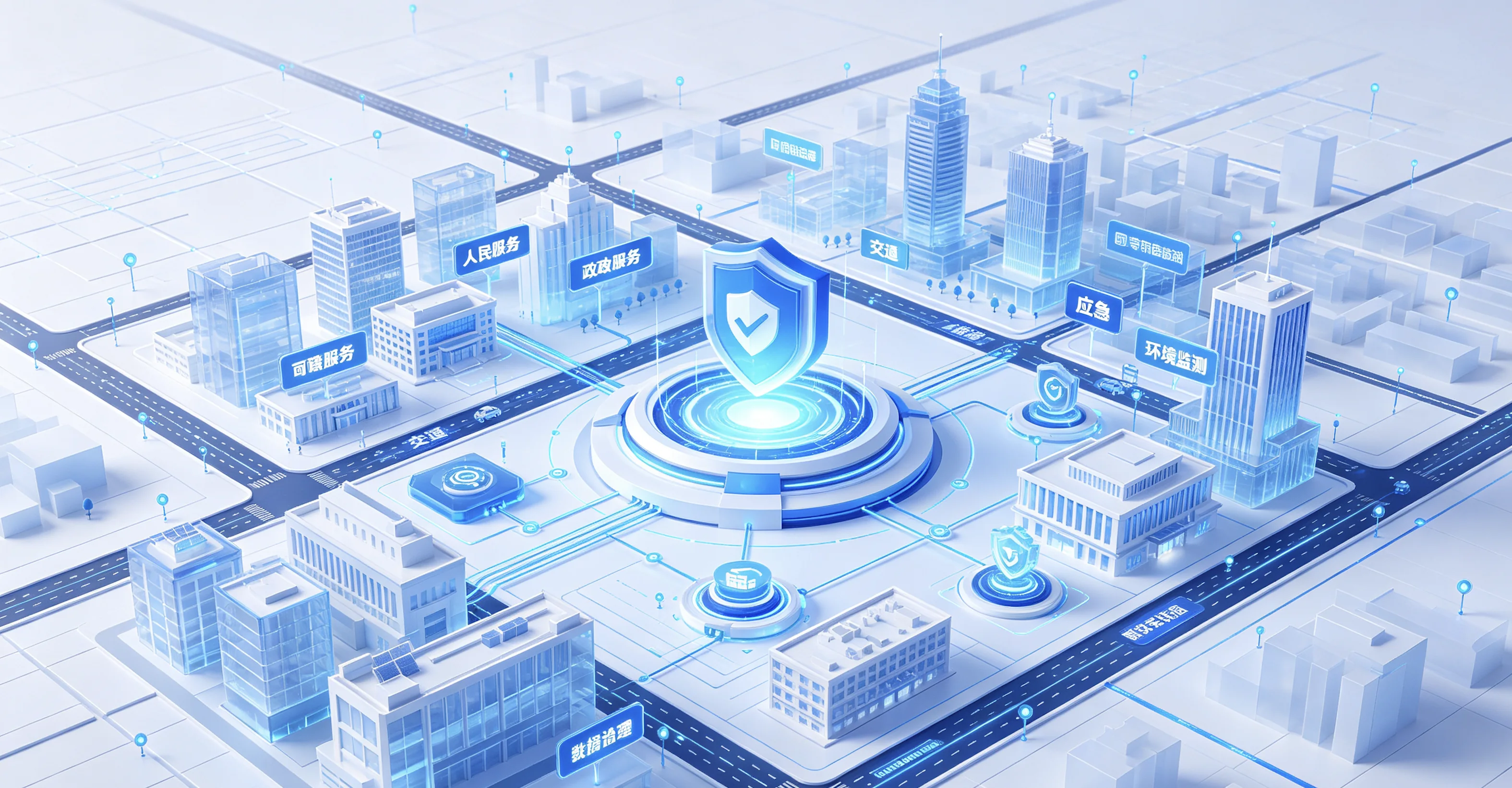
The architecture begins with urban space and multi-source data, then runs governance, agent coordination, and application construction on one platform. Specialist departments retain their systems and responsibilities. Standard interfaces, thematic datasets, and a common incident model connect them without making wholesale replacement a prerequisite.
Identity, access, data classification, operational audit, and service monitoring define managed boundaries for sharing. New scenarios reuse spatial services, trusted data, workflow building blocks, and intelligent capabilities instead of rebuilding them. The result is a city capability system that can expand while remaining understandable and governable.
Five-layer capability architecture
Urban spatial layer
Maps, buildings, facilities, and priority areas provide shared coordinates for incident location, situational views, and spatial analysis.
Data governance layer
Government, sensor, and social data are connected through catalogs, standards, quality controls, lineage, and authorized-use policies.
Intelligence layer
Knowledge retrieval, rule recognition, assisted assessment, task orchestration, and multi-agent coordination support operational work.
Application delivery layer
Reusable components and low-code tools accelerate thematic dashboards, mobile response, service portals, and management applications.
Governance and operations layer
Teams continuously monitor data quality, workflows, model behavior, and user feedback so scenarios evolve with policy and practice.
Core scenarios
Organize intelligence around real operational journeys
Core Scenario One
Urban operations monitoring and integrated assessment
A shared operating view connects transport, environment, public safety, emergency response, infrastructure, and community services through interpretable thematic conditions.- Current challenge
- Conventional dashboards often aggregate charts without preserving business relationships. When an exception occurs, managers still return to several systems to locate the place, history, affected facilities, and responsible unit. Assessment remains slow and difficult to reuse.
- Solution approach
- The platform uses urban space as an index for live sensing, business records, incident history, and response knowledge. Thematic models connect indicator changes to locations, assets, events, and accountable organizations, giving each signal operational context.
- Operating model
- Specialist teams maintain indicator definitions and alert rules. When a threshold or pattern is detected, related evidence is assembled into an assessment brief. Duty staff can validate the finding, convene specialists, or convert it into a managed incident workflow.
- Expected value
- Leaders gain a consistent and traceable expression of city conditions. The basis for judgment can be shared, while recurring expertise becomes reusable rules, views, and response knowledge rather than remaining with individual operators.

Core Scenario Two
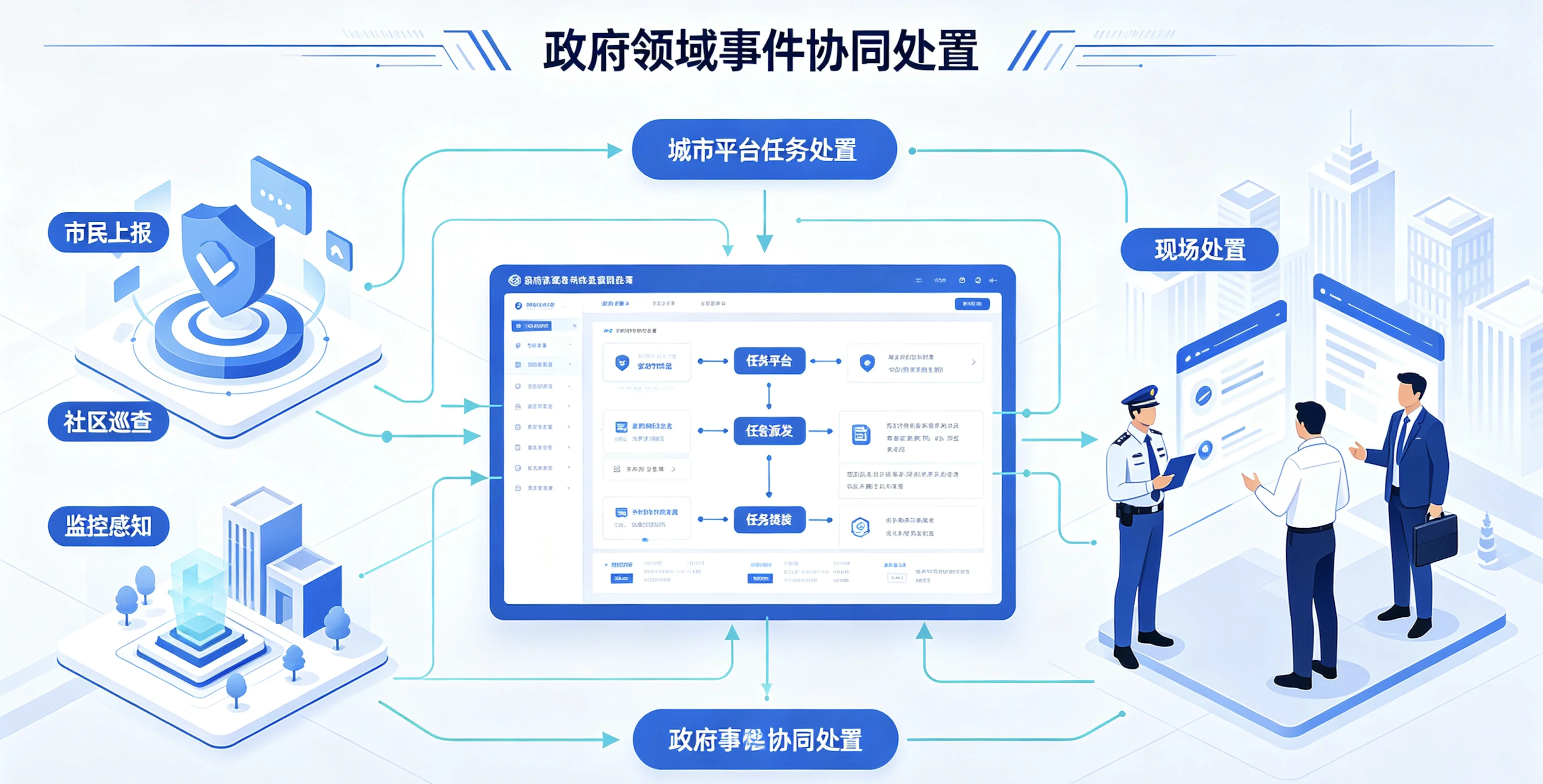
Coordinated cross-department incident response
A single incident thread connects discovery, intake, assessment, dispatch, field action, outcome feedback, and review so responsibility and progress remain visible.- Current challenge
- One issue may be reported through hotlines, inspections, neighborhood teams, and device alarms at the same time. Without a common identity, duplicate work is dispatched. Matters involving several agencies may circulate repeatedly when responsibility and evidence are unclear.
- Solution approach
- A unified incident model merges related signals into a complete record. Responsibility rules use location, category, and impact to support dispatch, while complex matters can create linked tasks that share field information, supporting evidence, and deadlines.
- Operating model
- Field teams receive tasks, location context, and relevant history on mobile devices, then return evidence and outcomes through the same record. Command roles track stage status and emerging delay risks. Completed matters remain available for review by category, area, and participating unit.
- Expected value
- The incident becomes a traceable collaborative process rather than a one-time ticket. Departments work from the same facts, repeated coordination is reduced, and rules can be improved using evidence from actual operations.
Core Scenario Three
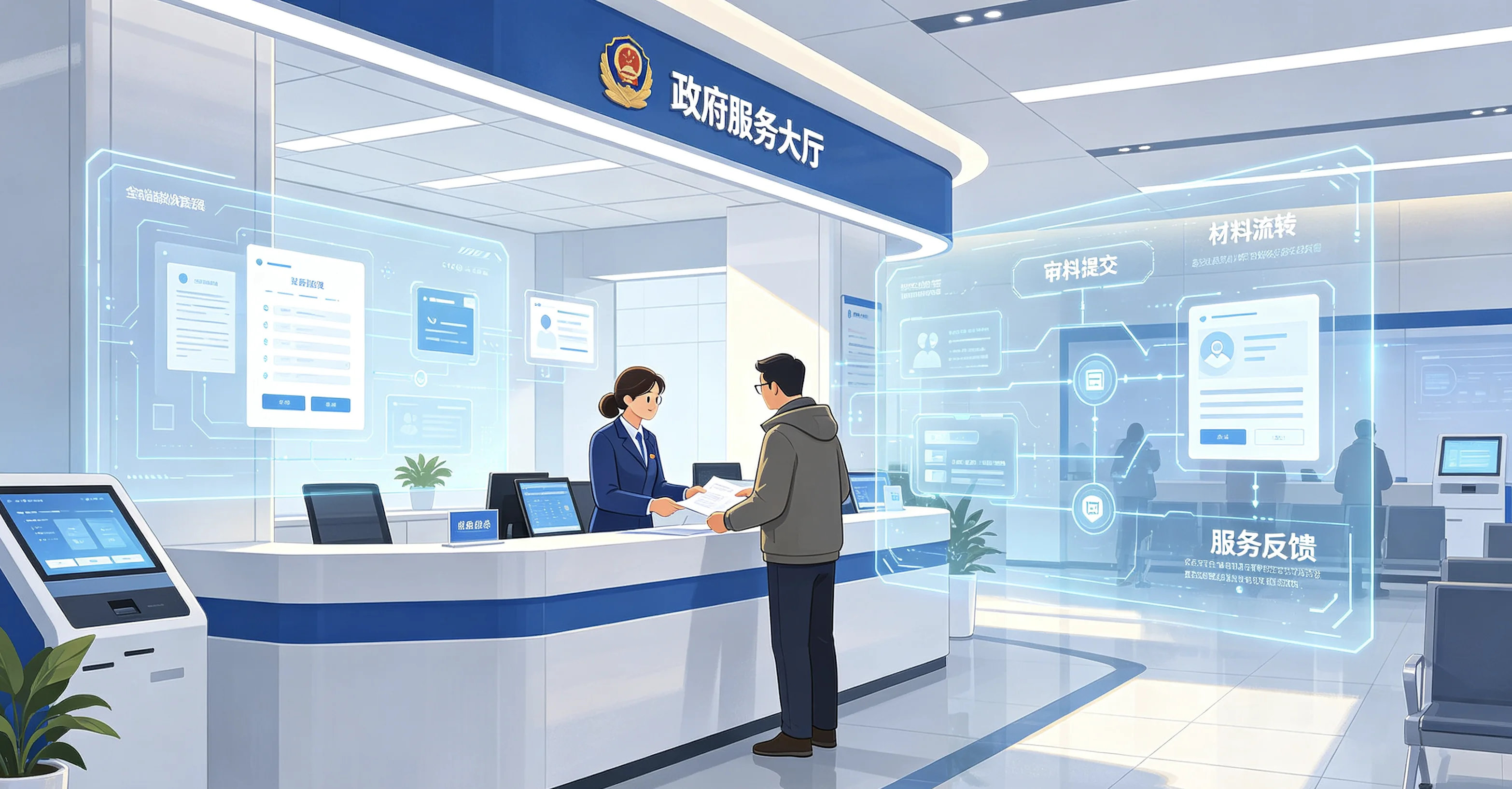
Integrated government service and intelligent assistance
Submission, intake, review, case circulation, progress inquiry, and service feedback are connected into a consistent experience for staff and the public.- Current challenge
- Service guidance, policy documents, and review experience are scattered across sources. Staff rely on personal familiarity when checking materials, while applicants struggle to understand rejection reasons and next steps. Cross-department services can also request the same information repeatedly.
- Solution approach
- A service knowledge base, material rules, and workflow orchestration establish shared standards. An assistant gives staff traceable policy retrieval, material-checking prompts, and procedural guidance while reusing already authorized foundational information.
- Operating model
- The service process retains material versions, review comments, and circulation status. Managers examine return reasons, common questions, and process bottlenecks, then improve guidance, forms, and collaboration rules without changing statutory responsibilities.
- Expected value
- Applicants understand requirements and progress more clearly, staff receive dependable task support, and service owners use real process evidence to improve service design and delivery quality.
Core Scenario Four
Trusted governance and capability operations
Identity, access, data, models, workflows, and applications are governed together so shared capabilities remain controlled across departmental boundaries.- Current challenge
- A city platform connects many systems, users, and sensitive datasets. When delivery focuses only on features, broad privileges, uncontrolled data movement, untraceable model answers, and unattended interfaces accumulate into long-term operating risk.
- Solution approach
- Unified identity and least-privilege access protect every operation. Data use, knowledge citations, agent tool calls, and workflow actions are recorded for audit. Important capabilities include release review, version ownership, and rollback paths.
- Operating model
- An operations team monitors data quality, service availability, knowledge freshness, model feedback, and application adoption. Organizational and policy changes trigger timely updates to privileges, rules, content, and operating responsibilities.
- Expected value
- Government teams reuse digital capabilities within explicit boundaries. Every new scenario inherits a consistent trust and governance foundation, moving the platform from one-time delivery toward sustainable operation.
Delivery roadmap
Move from an operational blueprint to continuous improvement
Operational discovery and governance blueprint
Map participating organizations, real workflows, data sources, existing systems, responsibility rules, and priorities around important public outcomes.
Stage deliverables- Current-state and problem inventory
- Scenario priorities and target blueprint
Foundation and governance construction
Establish the platform, spatial services, data catalog, identity and access, interface standards, and operating environment that every scenario will share.
Stage deliverables- Core platform capabilities
- Data and interface governance standards
Priority scenario pilot
Jointly build a scenario with clear boundaries and meaningful coordination value, then validate it with real users, processes, and operating data.
Stage deliverables- Pilot applications and mobile workflow
- Operational evaluation and improvement backlog
Scaled rollout and system coordination
Package reusable components, thematic data, and workflow patterns before expanding to additional areas, departments, and operating topics.
Stage deliverables- Scenario component and pattern library
- Rollout plan and coordination model
Continuous operations and capability evolution
Create operating ownership for data, models, workflows, applications, and user feedback so the system keeps pace with policy and practice.
Stage deliverables- Operating indicators and responsibilities
- Release, knowledge, and improvement process
Lasting value
Turn platform capabilities into lasting operational value
A shared expression of city conditions
Teams assess operations through common spatial, indicator, and incident facts, reducing differences in interpretation.
Traceable cross-department coordination
Responsibility, stage progress, field outcomes, and review conclusions remain connected throughout the operating chain.
Public services that can keep improving
Process evidence reveals material, workflow, and service bottlenecks so service design can evolve continuously.
Digital capabilities reused within clear boundaries
New scenarios inherit established data, spatial, intelligence, and governance services instead of repeating foundational construction.